I have spent most of my research life on machines that have to understand space they have never seen before. Every time, the hard part turned out not to be the model. It was that nobody could see what the machine was seeing.
At the Institute of Robotics and Machine Intelligence in Poznań, I worked on 3D perception with Dominik Belter. The problem there is legged robots on terrain nobody has surveyed: the machine has to build a picture of the ground from noisy depth data and then decide where to put a foot. When it went wrong, and it went wrong constantly, the question was always the same. What did it think the ground looked like at that moment?
Answering that took longer than fixing whatever was actually broken. We wrote one-off scripts to dump a point cloud, opened it in something else, and squinted. The tooling was never the research, so it never got built properly.
Later I worked on 3D action recognition at UCF. Different domain, different sensors, same day. A model would be confidently wrong about something a person would have caught instantly, and getting to the moment it went wrong meant building a viewer first.
By then I had stopped thinking of that as overhead. Two labs, nothing in common except three dimensions and time, and in both of them the thing slowing everyone down was that the data was easier to record than to look at.
Then I went looking for where that problem was worst, and found the ocean.
A survey vehicle goes down for a day and comes back with sonar in one file, the vehicle log in another, a CTD cast in a third and video on a drive somebody carries up from the deck. Four programs, four windows, four different ideas about what time it was. The first hour of the work is lining them up by hand so the second hour can start. Nobody in the room thinks this is strange. That is the part that got me.
It stayed that way for thirty years because software was an accessory to selling sonar. If your business is hardware, your file format is not a problem, it is a reason people come back. That held while one vessel ran one line at a time and a person could keep up.
That is over. The vehicles are autonomous now and there are more of them every year. Offshore wind and subsea cable are scaling. A browser can render a whole mission without installing anything, which was not true when I was writing those dump scripts. The bottleneck stopped being how much you can record and became how much anyone can look at.
Here is the detail I keep coming back to. Ask a survey team for the interesting moment from a dive and they will send you a screenshot. Not because they want to. A screenshot is the only artefact in the entire industry that reliably opens on somebody else’s computer.
We’re fixing that.
I started moonloop at Founders, Inc. to build the layer that should have existed the whole time. Studio is the workspace: drop a file in and see the dive straight away, sonar and track and telemetry and video on one timeline, with a link anyone can open without an account. Agent sits on top and answers questions across everything you have run, and says which mission and which timestamp each answer came from, because an answer you cannot check is not evidence. Autonomy takes what the platform learns and hands it back to the vehicles, so they see more of what they are flying over.
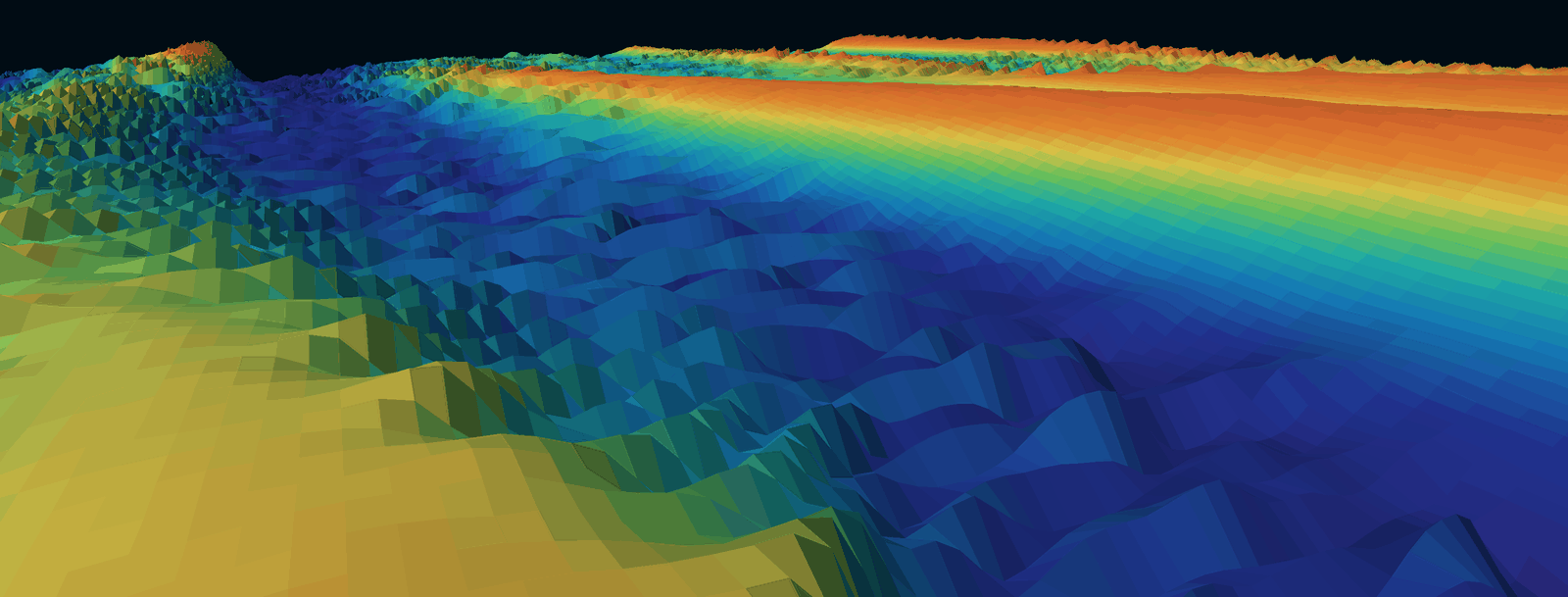
Sand banks at IJmuiden Ver, in the Dutch North Sea, as Studio draws them. Real bathymetry, from EMODnet.
Most of the seafloor has never been properly mapped, and that gets said a lot. The part that does not get said is that much of what we have surveyed is just as invisible, sitting in a proprietary file on a drive in an office, readable by one program and understood by one person.
The ocean isn’t unknowable. It’s unobserved. That is a much smaller problem, and it is a software one.
Keep reading